CAPE YORK Week 3 - July 2015
- Aug 2, 2015
- 5 min read
Day 15 - the big day. 123 km for the day having a look around after the Tip Drove directly there in the morning via Bamaga to try and beat the crowds. It's quite a nice drive through remarkably diverse country that included typical open Cape terrain and even some rainforest just south of the tip itself. Short hike over a rocky outcrop .... and there it is .....

There was only one other couple there before us and not too many others while we were there. So that was a pleasant surprise after stories of queuing for the obligatory photo. Allowed you to just take it all in. The ocean current running east to west was quite impressive. A lot of thinking, planning and preparations went into getting to this place, our first long-form camper trailer trip and imagining this moment, so it was a good time to make it a reality. Jill took this selfie, she's still learning the technique. And I'm taking a photo in the background if you're wondering.

Here I am sitting on the tailgate reflecting on it all. Can't beat a tailgate.
The Tip is just over those mangroves and that headland is actually the island across the narrow channel.

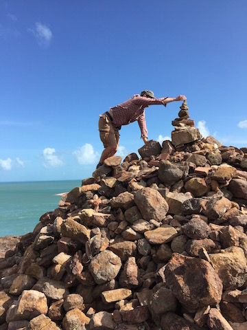
Here's my contribution to one of the cairns along the walk from car park to Tip.
It's all south now .... well not quite, some west too actually. And still quite a few things to see on the Cape as well. But first, photographic proof ....

After the tip we headed back south and had a quick look at the Somerset ruins (not much to see) and Somerset Beach, which appears a very nice spot to camp actually. There were people taking a 4-wheeler on a little barge over to the island across the way. Looked like maybe a small resort or something. Then it was lunch at Punsand Bay, which looked like another excellent spot to spend a few days but with a restaurant, toilets, showers, etc.


Really the Cape has an embarrassment of riches when it comes to camping holidays but unfortunately we were moving on in a couple of days. I guess I thought of it as a simple destination or milestone but the number of quiet, out-of-the-way places to stay that are really beautiful is quite amazing. And there's plenty of sites to see too. Next was the mandatory stop at the Croc Tent

And then back to Bamaga for supplies and Umagico for sundowners. Another great day.

Day 16 - covered 58 km.
There is apparently a number of excellent 4WD tracks around the area, such as "5 beaches" on the east side but there was not a huge level of interest in lots of driving from any of us in the group. All were keen to check out the WWII plane wrecks (close by) and then just generally enjoy a day at camp back at Umagico. I now realise we could have made good use of a couple more days exploring the tip area. Cape York Pro Tip #4 - The map from the Croc Tent is free and excellent for navigating to all the points of interest at the Tip. The DC3 wreck is really quite intact for a crash 70 odd years ago.

The Beaufort is less intact. It held some significance for me because my Grandfather flew these planes in WWII but not in Australia. He was actually seconded into the RAF and flew bombing missions across the channel. He was shot down, rescued from the channel by the Germans and was a POW for a few years.

Also had a look at Fly Creek down past the Bamaga airport, looked like good territory for swimming handbags. Here's our group's vehicle line-up.

Then we returned to camp for more excellent cupcakes, sitting around and more of this light.

Days 17 & 18 225 km back down to Bramwell Station. 331 km on to Musgrave Station. Back on the road again. We thought this leg put the worst of the corrugations behind us, which was a good feeling. However there was also a terrible section coming in to Laura where the bitumen starts when heading south Just a final kick in the pants that we didn't know about yet. Cape York Pro Tip #5 - The burger at Bramwell Roadhouse should not be missed. Anyway here's an artistic photo of the road.

After setting up the camper at Bramwell Station, we went and had a look up the Telegraph Track for a few km's. That first bit is not particularly hard and this is all I could find for a photo.

The kookaburras on the Cape are stunning.


For Day 18, there's not much to report other than spending time behind a road train is not much fun. The Archer River is beautiful and the camp site here looked really good, just didn't fit our timing. The camping at Musgrave Station is a nice setup and good value at $10. There's a bat colony and little freshwater crocs in the small pond behind the campsite.


Lot's of people in the campsite that afternoon and night but no problems with noise.
Days 19 & 20 - 352 km to Julatten. That's 2,645 km since Cairns and 4,350 km since leaving Brisbane.
This day saw the end of the dirt and the end of the Cape but marked the start of the next section of the trip to Outback Queensland via the Atherton Tablelands. Hann River Roadhouse was a quick morning tea and once again looks a good place to camp for the night, with a large grassy and tree covered field out the back.

Lunch was at the Palmer River Roadhouse, now well and truly on the bitumen.Guess which one has been to Cape York.

Julatten is a small place just down from Mount Molloy but still up the range from Cairns. The little van park there is excellent and run by a very nice couple. It's known for its bird watching opportunities and we did see plenty, including kingfisher. We stayed two nights, kind of decompressing from the Cape and planning the outback loop, which hadn't been worked out in advance. Day 20 was spent in Julatten with a bit of a drive up Mt Lewis, which is very nice rainforest country. For the record we also noticed an excellent free camp on a creek just outside Mount Molloy which itself looked a great little town when we drove through two days later. It did look popular (read busy).
The outback loop itinerary was decided as heading to Winton via Atherton and Hughenden. Then working our way home via Longreach and Carnarvon Gorge. So there'll be a few posts coming up on Atherton, Blackbraes National Park, Winton, Longreach and Carnarvon Gorge. We considered going out to Birdsville but decided it would be too rushed and could be saved for another trip into the red centre.
Days 21 & 22 - 102 km drive to Atherton via Mareeba across the tablelands. Left the Julatten campground at a civilised hour thanks to an easy drive distance for the day.

Picked up some local coffee at Mareeba to try out in the Bialetti.

We stayed at the Big4 in Atherton. Excellent van park and Atherton is a nice little town. For Day 22 we drove 122 km around the tablelands looking at stuff. Cafe in Yungaburra ...

Millaa Millaa Falls

Also visited Mt Hypipamee Crater and Dinner Falls. Saw a few signs like this but unfortunately nothing in the flesh.

The tablelands are a beautiful part of the world and a good transition from the cape to the outback, which you'll need to continue to Week 4 to read about.


Comments